History
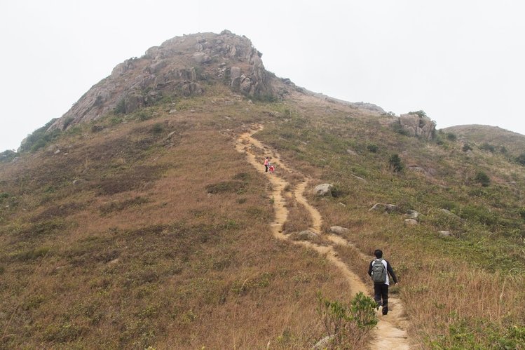
Tigers Head is also known as Lo Fu Tau in Chinese. You may wonder why it called Tiger’s Head! It is called Tiger’s Head because there’s a huge rock at the summit of the mountain shaped like a tiger’s head! It is very famous! It is approximately a two to four-hour hike.
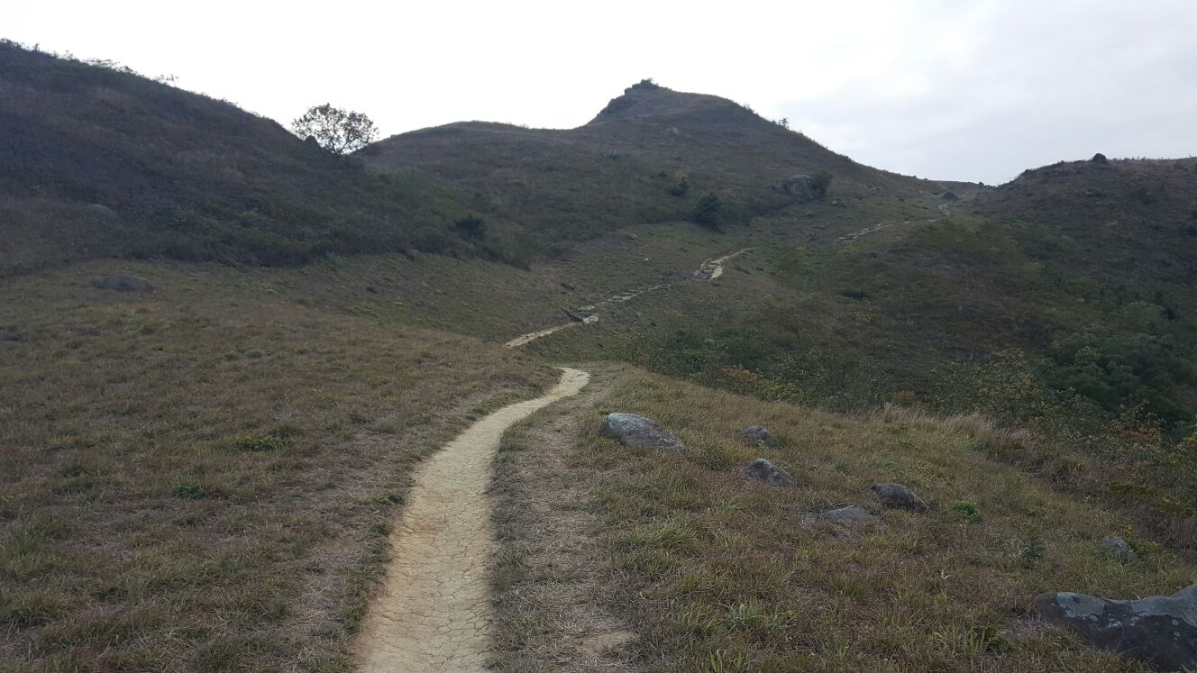
The Hike consists of stairs, rocky trails, dirt trails and steep hills. The mountain was given this name because many people think that the giant rock at the top resembles a tiger’s head. It is one of the finest trails in Hong Kong. It is in the perfect location right next to the airport where you can hear the roaring sound of the Boeing 747! At the end of the hike, the view is unbelievable. It takes about an hour to reach the summit. The paths among the grasses look very much like the stripes on the back of a tiger’s neck. Looking from this direction, the rock resembles a tiger overlooking Discovery Bay on its feet. From the lookout point, you can see the skyscrapers of Central just a few kilometres across Victoria Harbour. The top rewards you with a 360° panorama. To the south is Discovery Bay Golf Club. You can also see the engineering project of the Macau Bridge. It is mind-blowing and fascinating to see all of this!
The Hike consists of stairs, rocky trails, dirt trails and steep hills. The mountain was given this name because many people think that the giant rock at the top resembles a tiger’s head. It is one of the finest trails in Hong Kong. It is in the perfect location right next to the airport where you can hear the roaring sound of the Boeing 747! At the end of the hike, the view is unbelievable. It takes about an hour to reach the summit. The paths among the grasses look very much like the stripes on the back of a tiger’s neck. Looking from this direction, the rock resembles a tiger overlooking Discovery Bay on its feet. From the lookout point, you can see the skyscrapers of Central just a few kilometres across Victoria Harbour. The top rewards you with a 360° panorama. To the south is Discovery Bay Golf Club. You can also see the engineering project of the Macau Bridge. It is mind-blowing and fascinating to see all of this!
Activities
|
Activity 1: "Hiking bingo/scavenger hunt" How to play: make a list of items found in nature for everyone to find, whoever finds all of them first wins
Activity 2: "Hiking vocabulary" How to play: Find something in nature that starts from letter A-Z, when you finish finding all things in nature that vary from letters A-Z, give yourself a pat on the back and a chocolate bar! Activity 3: "Nature Colleague'' How to play: Find things in the nature like stick and rocks, and at the end of the trip make a colleague out of all the items. The best one gets a pat on the back and a chocolate bar. |
|
Routes
|
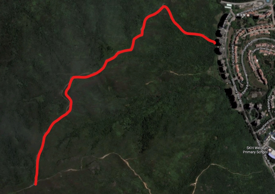
Routes to reach the top (Tiger's Head) can be very confusing and you can not even reach the top. There are three places that you can start on. There are lots of places you can start from but these are the most direct ad closest.
Route 1: (Approx: 3Hrs - 4Hrs) (Intensity: Easy - Medium) *Recommended* Start: Greenbelt Court (Greenvale Village) End: Discovery Bay Golf Course Route 2: (Approx: 2.5Hrs - 3.5Hrs) (Intensity: Easy - Medium) Start: Discovery Bay Golf Course End: Greenbelt Court (Greenvale Village) [Route Two is Reverse of Route One] Route 3: (Approx: 4Hrs - 5.5Hrs) (Intensity: Medium) Start: Greenbelt Court (Greenvale Village) End: Nim Shue Wan (South Discovery Bay) Route 4 (Approx 2Hrs - 3.5Hrs) (Intensity: Easy - Medium) Start: Discovery Bay International School (Discovery Bay Road) End: Discovery Bay Golf Course These Routes are the most common. |
Method One (Part 1/4)
(Approx: 1Hrs - 2.5Hrs) (Starting from Greenbelt)
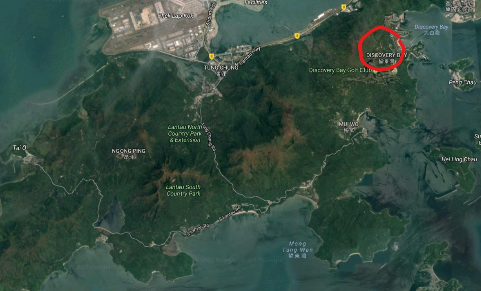
Location of Discovery Bay (Northern Lantau)
|
Risks
When Hiking, things can happen unexpectedly. You can do stuff with no thinking! We've listed out the most likely things that may happen whilst hiking you may want to watch out for!
Danger |
Affect |
Prevention |
Steep cliffs |
Falling off, causing severe injuries or in some cases, death |
Stay away from steep cliffs, keep to the mountain side or secure railings |
Dehydration |
Light headed, dizzy, faint |
Drink more water frequently! |
Uneven paths |
Tripping, falling to cause injuries, cuts etc. |
Watch your step, walk carefully and slowly |
Loose pebbles |
Tripping, falling to cause injuries, cuts etc. |
Test the path before stepping |
Ecology
Along your delightful way on the Tiger's Head hiking trail, you will bump into many cute and adorable animals, mainly birds. You will also spot many different varieties of plants too! Here are some examples......
|
These birds are very common and have a constant presence in Hong Kong however, we were not able to locate any of them during the hike. There are specific species that live here. Kites are mostly black and have around half a meter of wingspan. Crows are completely black and known for the intelligence and adaptability. They have a huge reputation for damaging and eating crops, therefore scarecrows were invented. Sparrows have a small wingspan and have a bigger chest.
|
|
Conclusion
Overall, this trail is perfect for a family with kids from starting from the age 7. It is not to hard and it can be easy to get to. This trail consists of steep inclines, level lengths of trail and steep to moderate slopes. If you have children below 7, it could be a tough time for you and your child. Starting from Greenbelt is difficult to get on the right trail due to the start of the trail. The start of the trail, you will have to go up a rain drain to start the trail and there are a couple spots that the rain drain fork off from. Once you pass a couple of them you are at the start. During that little bit it will only take you 50 seconds to 100 seconds if you get the path right.
The first bit of the trail consists of steep rocky inclines and tuns. It seems bat but it’s not that bad. One you get through it is a gradual to moderate incline that doesn’t have such large amount of rocks. When you reach the first point, the trail splits in two. One goes right and the other goes left. You will go left up the path that looks like stairs. Even though, there are no stairs.
From there, the trail is consistent in it’s level for about 5 to 10 mins. After those minutes, waves of steep incline start to come. These inclines can last a total of 20 to 30 mins. This is one of the hardest parts of the trail. After the incline reach an end, the trail goes down a bit. And then stays level for a bit. There will be a couple of steep inclines. There are not as steep as the ones previously.
Next, you will be faced with tigers head in front of you. To get to the top, It is pretty steep. It lasts for a bit. Half way up this incline, stairs start to appear. This lasts for about 2 to 7 minutes. One you get to the top, the view is amazing. It is so high and windy. Sometimes you can be in the clouds and it can be cold even though it can be the middle of summer.
The way down can be difficult to find. It can be missed very easily. The way down goes off another trail. It breaks off onto another trail. I comes about 2 to 7 minutes from the top. The way down is a straight slope. You should be careful going down. From there, the trail to the Discovery Bay Golf Course Road.
From there, you can walk down the road to make it to the Discovery Bay Main Road. The walk to the bottom is about 10 to 20 mins and it is steeper than a normal sloped road. On the way down you can go to the rock pools. They are about 5 mins down the road. If you go up the road, you will make it to the Discovery Bay Golf Course. At the Golf Course, you can have dinner or do some golfing. You can also catch the bus that will pull up to the temporary bus terminus. They recently closed the old bus terminus to upgrade it to a more efficient terminus for the busses. This will take about 2 - 3 years said Discovery Bay Transportation Services Limited.
